Techgoondu is heading down Thursday morning for an announcement by Google and the Land Transport Authority (LTA).
What could it be?
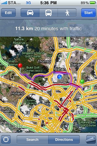
According to the media invite teaser, I am guessing it could well be a data blend between LTA’s live traffic update and Google Maps’ routing feature (that thingamajing which tells you the route to take from point A to B).
Google Maps already employ a crowdsourced solution in certain US states which tracks (anonymously, or so Google says) the movement of mobile phones when users opt in to the My Location feature and aggregates this data into an average representation of prevailing traffic conditions.
Will Singapore’s Google map be a mix of LTA’s data and big G’s crowdsourced solution? Would there be more stuff like SBS Transit’s Intelligent Route Information System (iris) which estimates arrival time of buses from a bus stop built in?
What we do know
Certainly, it’s gonna be a free service. Google probably won’t be transferring the cost of acquiring this data direct to its users.
It’s also possibly going to be weaved into Google Map without the need for additional cumbersome interfaces like another app download or a phone OS update (hooray!)
Counting down
Personally, I use Google Maps on my iPhone as a personal “get-me-out-of-here” navigator or to check if the taxi driver is trying to fleece me by taking a longer route (most are aghast when I wave my phone at them as evidence) . With Street View on the way, pedestrians (and cab addicts) are going to be so empowered!
To get the scoop, read this space by lunchtime tomorrow (19 November) for the latest as we post direct from the event ;p


